The West Highland Way is a trail from Milngavie north of Glasgow to Fort William in the Scottish Highlands. There are loads of suggested itineraries online and its pretty easy to get caught up in what some perceive to be the proper way to walk it, but we decided to begin partway through, spend two nights in one place when possible, and take day hikes to get off the beaten path.
The train from Glasgow to Tyndrum was easy and scenic. The town itself is tiny - just a few homes, restaurants, inns and campgrounds, all of which exist mainly because the West Highland Way goes through it. We stayed in a tiny, cylindrical hobbit cabin (see photo), identical to what is found at most campsites along the trail.
We went for a short hike the afternoon we arrived and decided to attempt to summit Ben Lui the following day, since we read that the approach is less boggy than the trail to Ben Oss.
The trail from town to the base of the mountain was a dirt road that eventually reached a gorgeous valley surrounded by lush hills,
referred to as various names - Grahams, which are 2,000 feet, Corbetts, which are over 2,500 feet, or Munros, which are over 3,000 feet. We later learned that there are 282 Munros in Scotland and, of course, some people have hiked them all multiple times, according to a Scottish guy we met.
Unfortunately, we encountered some pretty typical Scottish weather on the approach. We could barely see the bottom of the mountain and the top shrouded in clouds. The rain was light and intermittent but the winds were steady at My poncho no longer seemed like the ideal protection from the rain:
We began to ascend the rock staircase and after 20 minutes the conditions worsened. It didnt take much imagination to realize that the weather would be much worse at the top and that there would be no view, so we retreated.
We detoured to the West Highland Way and walked south - the opposite direction wed be walking the next day.
The trail is similar to El Camino de Santiago, which I walked part of last month. Its wide and is a variety of surfaces - dirt, gravel, asphalt,
etc. - and at times runs parallel to busy roads. However, the scenery is better and the towns are far less populated and less majestic / romantic. It also crosses low passes, so it isnt terribly hilly considering the topography of the area.
We decided to have a transport service take our heavy packs from town to town so we could enjoy the walking more. After a couple of hours, the trail veered father away from the highway and the whines of motorcycles disappeared, making for a beautiful walk along an old carriage road that was constructed in the 1700s with rocks smaller than cobblestone for the wealthy to reach their summer estates without breaking their wagon springs. The surface is eventually hard on the feet since no step is quite flat.
When doing research on the trek, it was difficult to find much information on what kinds of shoes to wear, and some people said you would be fine wearing tennis shoes or sandals. But that would probably not go well regardless of weather conditions. Im glad I ditched my walking sandals and switched
to lightweight boots before Scotland. The trail is pretty rocky (sometimes large loose rocks and sometimes fixed, jagged ones) and some sections would turn into basically a creek in rainy conditions. Only boots or trail shoes would handle this without likely foot problems, and gaiters wouldnt be a bad idea either. There werent any stream crossings during this time of year but some of the side trails apparently get very boggy (some reviews described stepping into mud), another reason to not just wear regular tennis shoes.
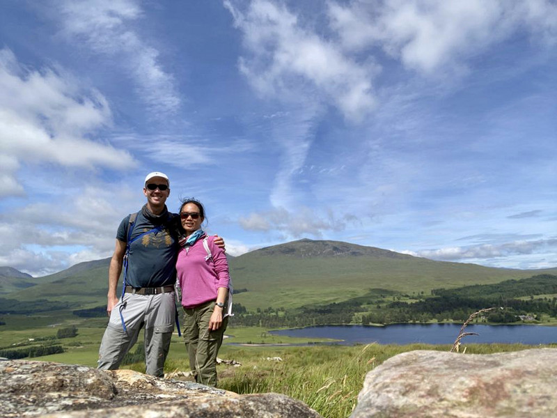
Unfortunately, the hike begins at a ski hill and follows the chair lifts. Its basically all uphill for 2 hours. We had another rare sunny and warm day, so the peak afforded vast views in all directions and it enough to eat lunch in shorts and a tshirt.